5 Best Hiking Trails in Switzerland Near Mont Blanc
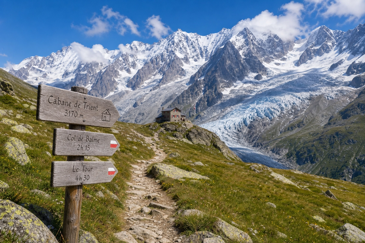
When most people think of hiking in the Swiss Alps, they immediately picture the crowded trails beneath the Matterhorn or the heavily trafficked routes of the Bernese Oberland. But for those in the know, the western edge of Switzerland—specifically the Val de Bagnes and the Liddes region—offers something far more compelling. Here, you get the dramatic, jagged grandeur of the Mont Blanc massif without the elbow-to-elbow foot traffic of Chamonix.
Hiking the Swiss side of Mont Blanc is an exercise in pristine alpine wilderness. You trade the commercialized gondola lines for authentic mountain culture, deep valleys, sweeping glaciers, and some of the most spectacularly engineered trails in Europe. For solo travelers, digital nomads, and budget-conscious adventurers, this region serves as the ultimate playground.
Whether you are acclimatizing for a multi-day trek or looking for a singular, unforgettable day hike, the trails radiating from the Swiss-French-Italian borders are unmatched. In this guide, we break down the five best hiking trails in Switzerland near Mont Blanc, complete with turn-by-turn insights, logistical frameworks, and essential alpine advice.
The Strategic Advantage of the Swiss Side
Before we dive into the specific routes, it is crucial to understand why the Swiss flank of the Mont Blanc massif is the preferred choice for experienced trekkers and community-focused adventurers.
- Fewer Bottlenecks: Chamonix (France) and Courmayeur (Italy) act as the primary magnets for Mont Blanc tourism. The Swiss side, characterized by the Val Ferret and the St. Bernard Pass region, filters out the casual tourists. The people you meet on these trails are generally dedicated hikers.
- Impeccable Trail Infrastructure: The famous yellow Swiss trail signs are meticulously maintained. Time estimates are remarkably accurate (calculated for a moderate walking pace without breaks), and the paths are graded for safety even in rugged terrain.
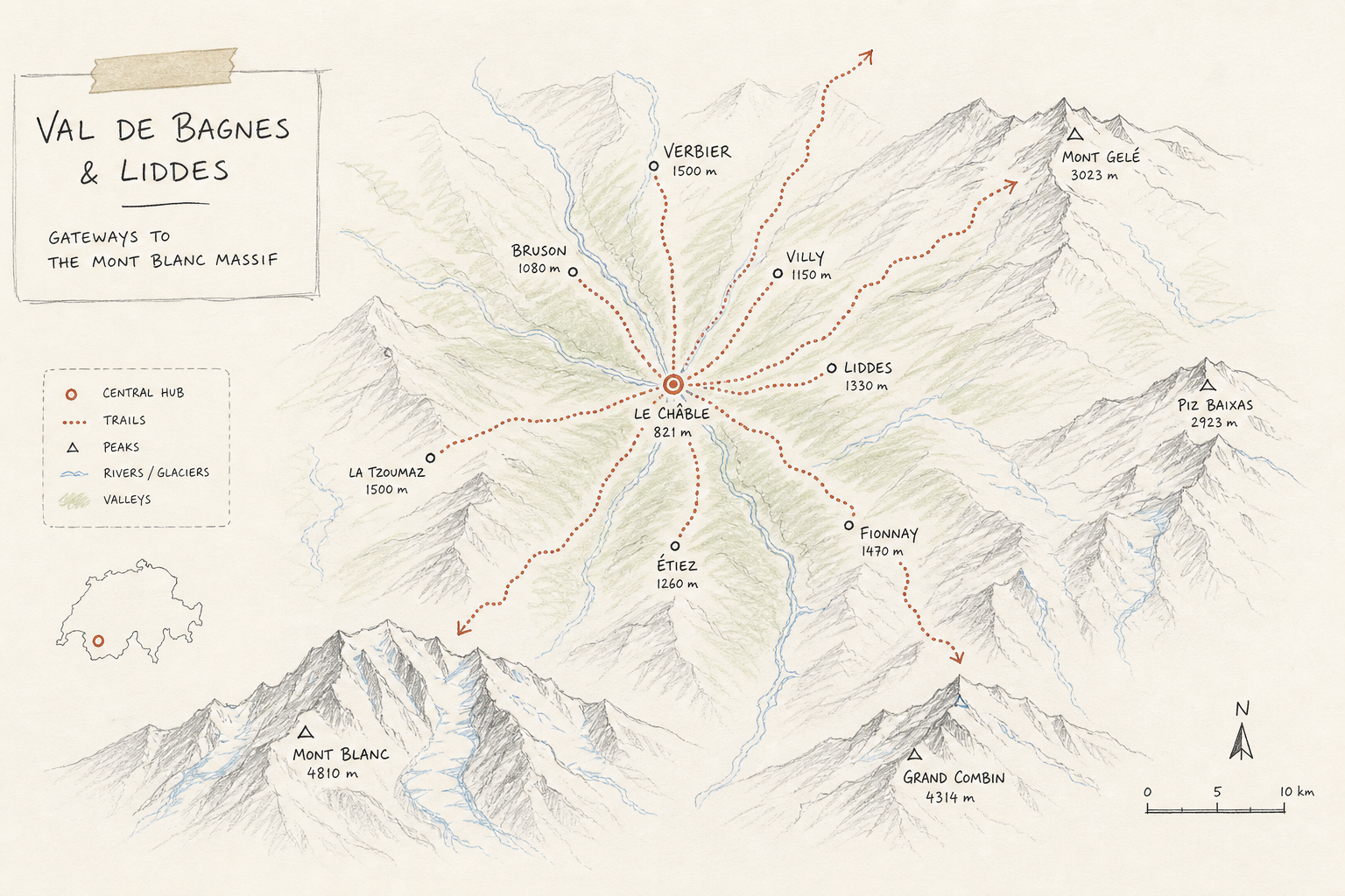
- Community-Centric Basecamps: Instead of paying exorbitant prices for luxury hotels in highly commercialized resort towns, the Swiss valleys like Liddes support a more communal approach to mountain tourism. You can base yourself in a centralized hub, rely on local transport or organized shuttles, and tackle different alpine zones each day.
Let’s explore the five standout trails that offer the best views, the most engaging terrain, and the truest alpine experience.
1. Fenêtre de Ferret & Great St. Bernard Pass
If you want to experience the historical weight of the Alps while staring straight down the barrel of the Mont Blanc massif, the hike up to the Fenêtre de Ferret is unparalleled. This route takes you from the historic Great St. Bernard Pass—a route used by Napoleon and the Romans—up to a natural “window” on the Swiss-Italian border.
Key Trail Statistics
| Metric | Detail |
|---|---|
| Distance | 12.5 km (Loop) |
| Elevation Gain | +850m |
| Difficulty | Moderate to Challenging |
| Average Time | 5.5 to 6.5 hours |
| Starting Point | Great St. Bernard Pass (Hospice) |
Turn-by-Turn Route Navigation
The Ascent to the Window:
The trail begins at the Great St. Bernard Hospice. Instead of heading south into Italy, you veer right (west), following the signs for the Fenêtre de Ferret. The initial climb is rocky and barren. At over 2,400 meters, you are well above the tree line. The path consists of loose scree and ancient bedrock, requiring sturdy footwear and focused foot placement.
The Border Crossing:
As you reach the Fenêtre de Ferret (2,698m), you are literally standing on the border of Switzerland and Italy. The view that opens up is staggering. To the west, the Grandes Jorasses and the eastern flank of Mont Blanc dominate the skyline. This is a classic spot where AllTrails’ top Swiss recommendations frequently highlight the dramatic shift in landscape from stark rock to glaciated peaks.
The Descent via Lacs de Fenêtre:
Crossing over the ridge, you drop down toward the Lacs de Fenêtre—three stunning alpine lakes that perfectly mirror the Mont Blanc massif on a calm day. This is the ideal spot for lunch. From the lakes, the trail loops back around the lower flanks of the mountains, eventually winding its way back up to the St. Bernard Pass.
The Crux of the Trail
Altitude is the main challenge here. Starting at 2,400m means the air is notably thinner. If you have just arrived from sea level, the initial 300m climb will feel twice as hard. Hydrate aggressively and maintain a steady, sustainable pace.
Ideal Hiker Profile
This trail is perfect for history buffs and photography enthusiasts. Because it is a loop, it offers constant visual variety, making it highly rewarding for solo travelers seeking a profound, quiet mountain experience.
2. Cabane de Mille: The Panoramic Balcony
Not every great hike requires a border crossing. The trek to Cabane de Mille is a quintessential Swiss alpine experience that offers one of the widest, most unobstructed 360-degree panoramas in the entire Valais region, directly facing the Mont Blanc massif to the southwest.
Key Trail Statistics
| Metric | Detail |
|---|---|
| Distance | 14 km (Out and Back) |
| Elevation Gain | +1,050m |
| Difficulty | Challenging (Due to sustained ascent) |
| Average Time | 6 to 7 hours |
| Starting Point | Bourg-St-Pierre or Liddes (depending on shuttle access) |
Turn-by-Turn Route Navigation
The Forest Approach:
Starting from the Liddes area, the trail initially winds through dense, fragrant larch forests. The incline is immediate and unforgiving. This section is an excellent test of your layering system, as the forest canopy traps humidity, but the alpine air remains cool.
The Alpine Pastures (Alpages):
Around 2,000 meters, the trees abruptly give way to expansive alpine pastures. Here, you will likely encounter the famous fighting Herens cows, easily identified by their muscular builds and deep-toned bells. The trail flattens out slightly, allowing you to catch your breath as the views of the Val de Bagnes begin to unfold below.
The Summit Push to the Hut:
The final push to the Cabane de Mille (2,473m) involves navigating an exposed, grassy ridge. Once you reach the modern, wood-clad hut, the reward is immediate. The terrace offers a direct line of sight to the Mont Blanc massif, the Grand Combin, and even the distant peaks of the Bernese Oberland.
The Payoff: Swiss Hut Culture
Reaching a “Cabane” (mountain hut) is the highlight of Swiss hiking. Cabane de Mille is renowned for its excellent fruit tarts and rich coffee. Stopping here for an hour to swap stories with other hikers, eat a slice of apricot tart, and stare at the glaciers is a mandatory part of the experience.
Ideal Hiker Profile
This route demands solid cardiovascular fitness due to the thousand-meter climb. It is excellent for hikers utilizing a “hub and spoke” basecamp strategy—those staying in the Liddes valley who want a massive, rewarding day hike without complicated logistical transfers.
3. Tour du Mont Blanc Segment: La Fouly to Champex-Lac
You cannot discuss hikes near Mont Blanc without including the legendary Tour du Mont Blanc (TMB). While the entire circuit takes 8-11 days, the Swiss segment from La Fouly to Champex-Lac is widely considered the most pastoral, charming, and culturally immersive section of the entire route.
Key Trail Statistics
| Metric | Detail |
|---|---|
| Distance | 15 km (Point to Point) |
| Elevation Gain | +450m / -550m (Net descent) |
| Difficulty | Easy to Moderate |
| Average Time | 4.5 to 5 hours |
| Starting Point | La Fouly |
Turn-by-Turn Route Navigation
The Valley Floor:
Unlike the grueling vertical ascents of other TMB stages, this leg is often referred to as the “rest day” by thru-hikers. Starting in the small village of La Fouly, the trail meanders down the Swiss Val Ferret, following the Dranse de Ferret river. The imposing east face of the Mont Dolent (the peak where the borders of France, Italy, and Switzerland meet) dominates your rearview mirror.
Through the Villages:
The trail weaves through tiny, picture-perfect hamlets like Praz de Fort and Les Arlaches. These villages feature traditional wooden chalets blackened by centuries of sun, resting on stone mushroom-shaped stilts (mazots). It is a striking contrast to the raw rock and ice you experience higher up.
The Climb to Champex-Lac:
The only significant physical challenge comes at the very end. Leaving the valley floor, you face a short but sharp 1.5-hour climb up through a dense pine forest to reach Champex-Lac. Often dubbed “Little Canada,” Champex features a pristine alpine lake surrounded by evergreens—a perfect place to soak tired feet.
The Crux of the Trail
The main challenge here isn’t physical; it is logistical. Because this is a point-to-point hike, you need to rely on public transport to return to your starting point or basecamp.
Ideal Hiker Profile
This is the premier choice for families, active recovery days, or hikers who prefer cultural immersion over high-altitude scrambling. It features heavily in lists like Wanderwego’s summer favorites for its accessibility and charm.
4. Cabane d’Orny & The Glacial Edge
For those who want to get up close and personal with the ice without requiring technical mountaineering gear, the trek to Cabane d’Orny is a high-altitude masterpiece. Hanging precariously on a rocky outcrop beside a massive glacier, this hike feels like a true alpine expedition.
Key Trail Statistics
| Metric | Detail |
|---|---|
| Distance | 9 km (Out and Back from the chairlift) |
| Elevation Gain | +650m |
| Difficulty | Challenging (Rocky, uneven terrain) |
| Average Time | 4 to 5 hours |
| Starting Point | La Breya (via Champex-Lac chairlift) |
Turn-by-Turn Route Navigation
The High-Altitude Start:
To bypass the grueling lower forest ascent, most hikers take the vintage chairlift from Champex-Lac up to La Breya (2,194m). From the moment your boots hit the dirt at the top station, you are enveloped in a harsh, spectacular world of granite and snow.
The Balcony Traverse:
The trail hugs the side of the mountain, traversing a long, exposed valley wall. The path is narrow but well-secured. Below you, the Combe d’Orny valley floor drops away dramatically. This section requires sure-footedness, as you will be navigating over large boulders and uneven rock slabs.
Arrival at the Glacier:
As you round the final bend, the Orny Glacier suddenly comes into view, its blue crevasses cracking in the summer sun. The Cabane d’Orny (2,831m) sits just off the ice. Watching mountaineers rope up to cross the glacier while you enjoy a hot soup on the terrace is an unforgettable experience.
The Crux of the Trail
Weather. At nearly 3,000 meters, conditions can change from sunshine to a whiteout blizzard in 20 minutes, even in August. You are entirely exposed on this trail with no emergency shelters until you reach the hut.
Ideal Hiker Profile
Adventure-seekers and experienced hikers looking for a dramatic, rugged environment. It often appears on compilations of Made to Explore’s bucket list hikes because of its raw, untamed aesthetic.
5. Croix de Fer & Col de Balme: The Border Ridge
To cap off the list, we look at the Col de Balme—the actual border crossing between Switzerland and France on the northern end of the Mont Blanc massif. The hike to the Croix de Fer (Iron Cross) offers what many consider the single best reveal of Mont Blanc in the entire Alps.
Key Trail Statistics
| Metric | Detail |
|---|---|
| Distance | 11 km (Loop) |
| Elevation Gain | +800m |
| Difficulty | Moderate |
| Average Time | 5 hours |
| Starting Point | Trient (Switzerland) |
Turn-by-Turn Route Navigation
The Ascent from Trient:
Starting by the famous pink church in the deep Swiss valley of Trient, the trail zigzags aggressively up the mountainside through shaded forests. The switchbacks are relentless but incredibly efficient, gaining altitude rapidly.
The Col de Balme Refuge:
Emerging from the trees, you reach the Col de Balme (2,190m). The moment you crest the saddle, the Chamonix valley explodes into view. Mont Blanc, the Aiguille du Midi, and the Bossons Glacier are laid out directly in front of you. It is a cinematic reveal that justifies every drop of sweat.
The Traverse to Croix de Fer:
From the Col, do not stop. Turn right (north) and follow the high ridgeline up to the Croix de Fer (2,343m). This extension takes you away from the TMB crowds resting at the refuge and offers a 360-degree vantage point. Looking back, you can see the deep valleys of Switzerland; looking forward, the towering spires of France.
The Crux of the Trail
The descent back to Trient via the variant route (Les Grands) can be steep and hard on the knees. Trekking poles are highly recommended here to save your joints.
Ideal Hiker Profile
Hikers who want the ultimate “reward-to-effort” ratio. The view of Mont Blanc from this angle is iconic and heavily referenced in Reddit community favorites as a must-do.
Basecamp Logistics: Maximizing Your Swiss Alps Experience
One of the biggest mistakes travelers make when hiking in Switzerland is the “nomadic hotel hop.” Packing up your bags, dealing with check-ins, and dragging luggage onto trains every single day creates immense cognitive fatigue.
For digital nomads, solo backpackers, and budget-conscious hikers, a “Hub and Spoke” model is vastly superior. This means choosing a central location and taking day trips (the “spokes”) out to different trails.
The Community Advantage
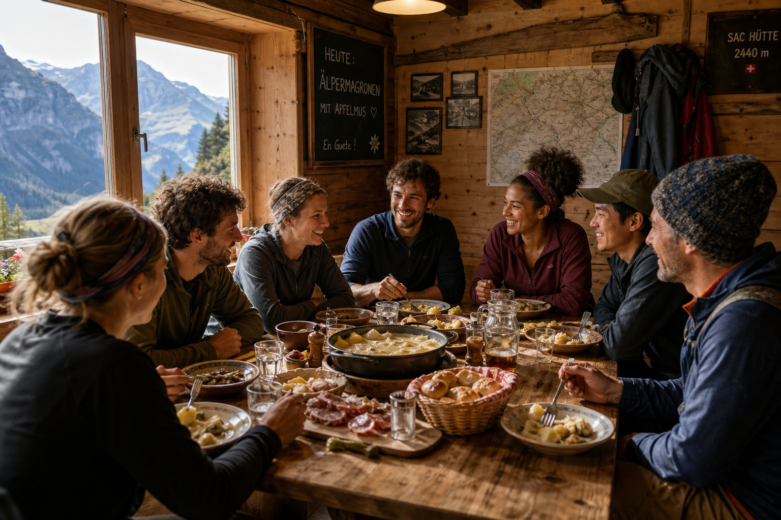
Traditional Swiss hotels are notoriously expensive and often lack a social atmosphere. This is where adventure hospitality concepts shine. Staying at a dedicated adventure lodge—like the Ski Hostel in the Liddes and St. Stephan regions—completely alters the alpine experience.
Instead of eating an overpriced, lonely meal in a resort restaurant, you return from the trail to a warm, “home away from home” environment. This community-driven approach offers distinct advantages:
- Managed Logistics: Let local hosts and volunteers organize the transport to trailheads like La Fouly or the St. Bernard Pass.
- Social Connection: Share trail beta, weather updates, and stories with international backpackers and digital nomads over communal, home-cooked meals (often featuring hearty Brazilian-influenced cuisine to refuel after a massive hike).
- Recovery: Access to high-speed Wi-Fi for those working remotely, combined with communal social events, spa nights, and BBQ gatherings to rest your legs.
- Gear Flexibility: Instead of flying with bulky equipment, taking advantage of on-site gear rental saves money and transit headaches.
Accommodation Matrix: Which Style Fits You?
| Style | Pros | Cons | Best For |
|---|---|---|---|
| Luxury Resort (Chamonix/Zermatt) | Premium amenities, room service | Very expensive, isolating, crowded | High-budget couples, luxury travelers |
| Mountain Huts (Cabanes) | True alpine immersion, on the trail | No privacy, basic facilities, weather dependent | Multi-day thru-hikers (TMB) |
| Adventure Lodge / Ski Hostel (Liddes) | High social connection, affordable, logistics managed, remote-work friendly | Shared spaces, requires short shuttles to trailheads | Solo travelers, digital nomads, budget hikers |
By leveraging an adventure lodge in the Val de Bagnes or Liddes region, you have direct access to over 250 kilometers of trails while maintaining a supportive, fun home base. It bridges the gap between rugged mountain isolation and a thriving international community.
A Hiker’s Framework: Assessing Your Readiness
The Swiss trails near Mont Blanc are heavily engineered, but they are not theme park rides. The mountains are indifferent to your fitness level. Before tackling routes like the Fenêtre de Ferret or Cabane de Mille, assess your readiness across three pillars:
1. The Altitude Factor
Most of these hikes take place between 2,000 and 3,000 meters. While this isn’t high enough to cause acute mountain sickness (HAPE/HACE) in most healthy adults, it is absolutely high enough to cause fatigue, mild headaches, and shortness of breath.
- The Fix: If arriving from sea level, spend your first day doing a valley-floor hike (like the La Fouly to Champex-Lac route) before attempting a 1,000m vertical climb.
2. Terrain Competency
Swiss trails are color-coded:
- Yellow: Standard walking paths. Wide, well-graded. Sneakers are okay.
- Red & White: Mountain trails. Expect rocks, roots, steep drop-offs, and potentially loose scree. Hiking boots are mandatory.
- Blue & White: Alpine routes. Technical terrain, glacier crossings, requiring hands for scrambling.
The trails listed in this guide are primarily Red & White. You must be comfortable with uneven footing and occasional exposure (steep drops on one side of the trail).
3. The Turnaround Time
Mountain weather in the Mont Blanc massif usually follows a predictable summer pattern: clear mornings, building clouds by 1:00 PM, and potential thunderstorms by 4:00 PM.
- The Rule: Plan to reach your highest elevation point before 1:00 PM. If you are delayed, turn around. Thunderstorms on an exposed rocky ridge like the Croix de Fer are incredibly dangerous.
The 3-Layer Alpine Packing System
Packing for the Swiss Alps requires acknowledging the microclimates. You might start your hike in a valley at 15°C, climb into a humid forest, and summit a windy, exposed ridge at 4°C. Lists compiled by resources like Journey Era’s 50 best hikes consistently emphasize the necessity of adaptable layering.
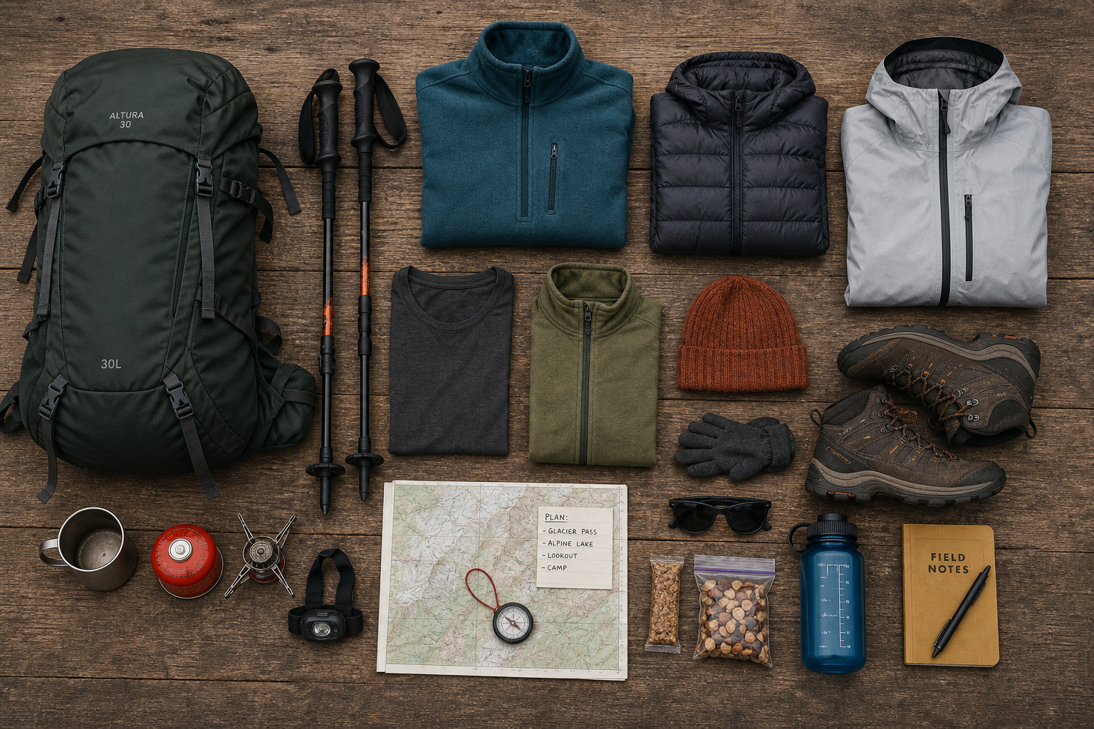
Here is the fail-proof packing system for a Mont Blanc area day hike:
1. The Base Layer (Moisture Management)
- What it is: A lightweight, breathable t-shirt or long-sleeve top.
- Material: Merino wool or high-quality synthetics. Never cotton. Cotton holds onto sweat, which will freeze you when you hit the cold wind at the ridge.
2. The Mid Layer (Insulation)
- What it is: A fleece jacket or an active-insulation synthetic puffy (like a Patagonia Nano-Air).
- Purpose: To trap body heat when you stop for lunch or when the sun dips behind the Mont Blanc massif.
3. The Shell Layer (Weather Protection)
- What it is: A lightweight, uninsulated Gore-Tex (or equivalent) waterproof jacket.
- Purpose: Wind is a constant above 2,500m. A shell blocks the wind from stripping your body heat and keeps you dry during afternoon squalls.
Essential Extras for the Swiss Flank
- Trekking Poles: Indispensable for saving your knees on 1,000m descents.
- Cash (Swiss Francs): While many mountain huts take cards now, the Wi-Fi card readers at 2,800m are famously unreliable. Always carry 40-50 CHF for that mandatory slice of apricot tart.
- Physical Map / Offline GPS: Download the SwissTopo app. It is the gold standard for navigating Switzerland, far superior to Google Maps for alpine topography.
Unwritten Rules of the Swiss Alps: Trail Etiquette
Integrating smoothly into Swiss hiking culture requires observing a few unwritten rules. Respecting these norms ensures you keep the locals happy and contribute to the positive atmosphere of the trails.
- The Greeting Protocol: It is customary to greet everyone you pass on the trail. In the Valais region (French-speaking), a simple “Bonjour” is standard. If you cross into the German-speaking areas, switch to “Grüezi”. Ignoring passersby is considered rude.
- Right of Way: Hikers going uphill always have the right of way. If you are descending, step aside and let the climbing party maintain their momentum.
- Leave No Trace, Not Even Cores: Do not throw apple cores or banana peels into the brush. While biodegradable, they take years to decompose at high altitudes and disrupt the local animal diets.
- Gate Management: You will frequently pass through electrified fences marking cow pastures. Always use the insulated handles to open them, and always clip them back into place immediately.
Frequently Asked Questions
What is the best time of year to hike near Mont Blanc?
The prime hiking window is remarkably short. From mid-July to mid-September, the snow is mostly cleared from the high passes (like Fenêtre de Ferret), and the mountain huts are fully operational. June can still feature deep, dangerous snowpack above 2,200m, and late September brings the risk of early blizzards.
Can beginners hike these trails?
Yes and no. The TMB segment from La Fouly to Champex-Lac is perfectly suitable for beginners and families. However, trails like Cabane d’Orny or Cabane de Mille require a solid baseline of cardiovascular fitness. If you are a true beginner, utilize the guided instruction and professional-led hiking guidance offered by hubs like the Ski Hostel to build your confidence.
Is public transport sufficient, or do I need a rental car?
Switzerland has the best public transit network in the world. The yellow Postbuses (CarPostal) reach deep into the valleys, including La Fouly and the Great St. Bernard Pass. A rental car is completely unnecessary and often a hindrance due to expensive, limited trailhead parking. Rely on the trains, the Postbuses, or the organized transport from your adventure lodge.
Final Thoughts on Conquering the Swiss Alps
The hiking trails in Switzerland near Mont Blanc offer a profound mix of physical challenge, visual splendor, and cultural richness. By stepping away from the overcrowded mega-resorts and exploring the deep, authentic valleys of Liddes and Val de Bagnes, you unlock a version of the Alps that most tourists never see.
The beauty of day hiking in Switzerland is that you can push yourself to the absolute limit on a glaciated peak by day, and still return to a warm, communal table by night. Whether you are navigating the historic Great St. Bernard Pass, staring down a glacier at Cabane d’Orny, or swapping stories with digital nomads over a home-cooked meal at your basecamp, the Swiss side of Mont Blanc will inevitably call you back year after year. Pack your layers, lace up your boots, and go experience the high-altitude magic for yourself.